
Digiqub was founded in 2022 by a team that has managed mechanical, electrical and construction projects for many years, with the aim of supporting the digital transformation activities of industrial facilities and providing products and services.

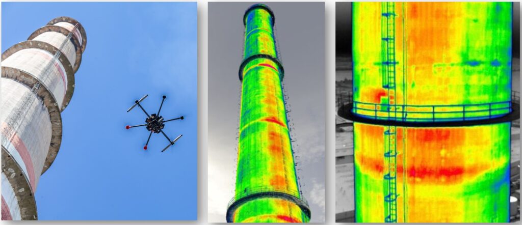
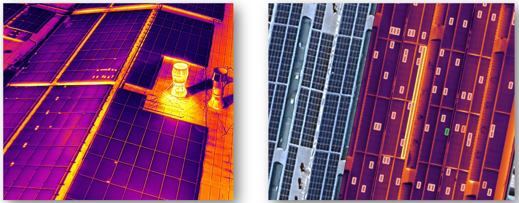
At Digiqub, we provide cutting-edge Thermal Mapping services utilizing drones equipped with advanced thermal and RGB cameras. This service allows for precise heat measurement and the identification of potential risks through visual and digital reporting. Thermal mapping is essential in identifying thermal anomalies that could lead to equipment failure, reduced efficiency, and even fire hazards.
What is Thermal Mapping?
Thermal mapping is the process of capturing heat data from a specific area using thermal cameras. Our expert thermographers analyze this data to detect anomalies, evaluate risks, and provide detailed reports. These anomalies, which may indicate inefficiencies or safety risks, are categorized into four levels:
Thermal mapping can be performed on a full site or in more specific areas, such as machinery, providing insight into both broad and localized heat patterns.
Why is Thermal Mapping Important?
Every industrial system produces heat at varying levels, which can affect performance, safety, and efficiency. Undesired heat can cause:
By detecting thermal anomalies early, corrective actions can be taken to prevent these issues, ensuring smoother operations, better safety, and cost savings.
How is Thermal Mapping Performed?
We offer both manual thermal inspections and autonomous drone-based thermal mapping. With drones, large areas such as factories, solar farms, and pipelines can be surveyed efficiently. The process involves:
Our drones, equipped with radiometric thermal cameras, capture real-time heat data, which is then processed using AI-based software to generate accurate thermal and RGB maps.
Applications of Thermal Mapping:
Our thermal mapping services can be applied in various industries, including:
Why Choose Drone-Based Thermal Mapping?
Drone-based thermal mapping offers several advantages:
By choosing Digiqub’s drone-based thermal mapping, you benefit from a fast, efficient, and comprehensive inspection service, ensuring your operations run smoothly and safely.
